Europe maps GNSS jammers mid-attack
Powerful GNSS interference over Europe exposes location-based controls as ineffective. Unauthenticated positional data is not a security boundary.
Opening position
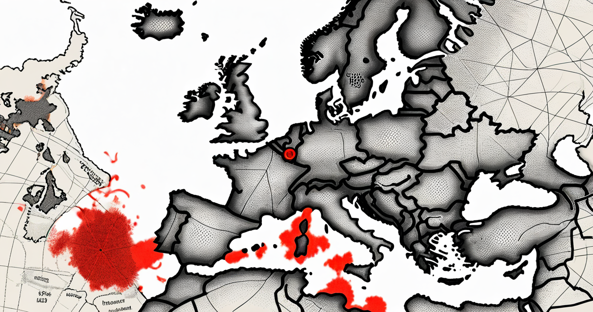
GNSS interference over Europe is not background noise from regional conflict. It is a targeted attack vector against any system that treats positional data as trusted input. Source mapping is now underway, which is a statement of capability, not a forecast. If a transmitter is strong enough and persistent enough to be geolocated across a continental footprint, it is strong enough to degrade operational systems within that footprint.
Positional data has been quietly absorbed into authentication, logistics, timing, and access control. It is no longer a navigation convenience. It is a control input. When that input can be manipulated from an identified source, every downstream system that consumes it inherits the compromise. Trust in coordinates is now a liability where it used to be an assumption.
The operator position is straightforward. If your control plane reads location, that control plane has a dependency on a signal you do not own, do not authenticate, and cannot validate at the receiver. That is the exposure. The interference event is the proof that the exposure is exploitable.
What actually failed
What failed is the assumption that civilian GNSS is reliable enough to anchor security and operational decisions. Receivers within the affected European footprint are returning positional data that does not correspond to physical reality, or returning no fix at all. Both are failure modes. The first is harder to detect because the receiver continues to report a valid-looking coordinate. The second is loud, but recoverable. The first is the one operators should care about.
The interference is described as powerful and traceable. That is the externally observable behaviour. It is consistent enough in signal strength and origin to be mapped from collected receiver data. The specific scale of affected critical infrastructure is not confirmed in the available information. The specific technique mix between jamming and other interference types is not confirmed beyond the stated position that this is not solely jamming.
What is confirmed is that operational visibility has degraded. Systems that depend on GNSS for location, timing, or geofencing are operating with inputs that no longer reflect ground truth. The failure is not at the satellite. The failure is at the trust boundary between the receiver and the control plane that consumes its output.
Why it failed
It failed because civilian GNSS was designed as an unauthenticated one-way broadcast. The receiver accepts the signal it gets. There is no cryptographic handshake between satellite and receiver in the standard civilian implementation. Any sufficiently powerful transmitter on the correct frequency can override, mask, or replace the legitimate signal at the receiver. The receiver has no native way to distinguish a legitimate satellite signal from a co-located terrestrial source impersonating one.
Location-based security controls were built on top of that broadcast and inherited its weakness. When a control gates access, session validity, asset tracking, or workflow approval on GPS coordinates, the strength of that control collapses to the strength of the receiver’s ability to verify signal origin. That verification is not part of standard civilian GNSS. The control was deployed on top of a substrate that does not enforce what the control assumes. By the rule that controls which are not enforced are not controls, location-based gating in affected regions is currently ineffective. It is in place, but it is not enforcing.
The second failure is the absence of receiver-side integrity signalling in most consumer and operational deployments. Receivers can detect anomalies in signal characteristics, but whether that detection is surfaced to the control plane is implementation-dependent. In most observed deployments, it is not. The control plane sees a coordinate and treats it as ground truth. There is no field on that coordinate that says this fix is degraded or this fix has been challenged by anomalous signal conditions. The control plane is blind to the quality of its own input.
The mechanism is straightforward. A receiver accepts the strongest qualifying signal on its tuned frequency. When the source of that signal is a transmitter the receiver does not authenticate, the receiver has surrendered the coordinate to whoever controls power and proximity. Source mapping confirms that a transmitter capable of dominating the link exists and is operating with intent across a continental footprint. That is the failure surface. Not the satellite. Not the receiver hardware. The unauthenticated broadcast itself, consumed as if it were validated.
The drift is in the abstraction layer above the receiver. Operational systems do not consume raw GNSS frames. They consume a coordinate object that has been stripped of signal quality, source verification, and anomaly state by the time it reaches the control plane. The receiver may have visibility into degraded signal conditions. Whether that visibility is surfaced to the consuming system is implementation-dependent, and in most observed deployments it is not. The control plane sees a coordinate that looks identical to a clean one. Decisions execute on it.
This is the same mechanism that breaks any control built on an asserted attribute the enforcement point cannot independently verify. The attribute crosses a boundary, loses its provenance, and is treated downstream as ground truth. The further the attribute travels from its origin without integrity context attached, the weaker the control that consumes it becomes. Distance from source is inverse to trust. Most architectures do the opposite. They centralise decisions far from the point of signal origin, then act as if the input is canonical. In the affected European footprint, that pattern is currently exposed.
The same pattern appears wherever a control gates on an attribute the system does not authenticate at the point of read. IP geolocation is a parallel. The address is observable. The mapping from address to physical location is asserted by a third party database. The control plane reads the mapping and gates access on it. There is no cryptographic binding between the user, the address, and the claimed location. Substitution at the path layer, by a VPN, a residential proxy, or a routing manipulation, defeats the control. The control was not enforcing physical location. It was enforcing belief about an address.
Device posture controls behave the same way when attestation is not continuous and not hardware-rooted. The endpoint asserts its state. The control plane reads the assertion and grants access. If the assertion can be forged, replayed, or substituted between attestations, the control reads stale or fabricated input and acts on it as live. The interval between attestations is an exploitation window. The longer the interval, the larger the window. Most deployments measure attestation in sessions, not in continuous validation against a trusted root. The control name is posture. The actual enforcement is a snapshot.
Timing is the harder parallel because GNSS is itself the trust anchor for time synchronisation in many systems. When the positional signal can be substituted at the receiver, the timing signal sourced from the same broadcast inherits the same exposure. Certificate validity windows, log sequencing, replay protection, and any cryptographic protocol that depends on a bounded clock skew operate on a clock with the same authentication properties as the coordinate, which is to say none in the standard civilian implementation. The mechanism does not change between the coordinate and the clock. Whether timing impact has materialised in the current event is not confirmed. The exposure is structural.
Location is not a credential. Time sourced from an unauthenticated broadcast is not a credential. Neither input authenticates itself, and neither becomes stronger by being read by more systems. Any control that gates on them in their unauthenticated civilian form is enforcing a convention, not a boundary. The interference event in the European footprint did not create this exposure. It demonstrated that the exposure is operational, reachable, and currently in use.
The control plane must hold the integrity context, not just the value. A coordinate without a signal quality field, an anomaly state, and a source verification result is not a security input. It is a hint. Hints do not gate access. Boundaries do. If the architecture treats a hint as a boundary, the architecture is the failure, not the signal. Source mapping of the interference does not repair this. Attribution is not enforcement. Knowing where the transmitter sits does not authenticate what the receiver consumes.
Identity remains the only boundary that can be made to hold under input substitution. Continuous validation against a cryptographic root, bound to every decision the control plane makes, is the posture that survives a degraded signal environment. Location-based gating in the affected footprint is not enforcing. It is in place, but it is not a control. A transmitter strong enough to be mapped across Europe is strong enough to invalidate every downstream system that treats its output as truth. The mapping is the proof. The next operational decision made on a positional input in that footprint is made on input the operator does not own and cannot validate.
Keep Reading
 telecom security
The zero-day wasn't the failure.
Luxembourg's national telecoms network collapsed from one Huawei zero-day. The failure was architectural, not vendor-specific. Concentration was the control gap.
 ICS security
Bitsight found 6,000 unauthenticated fuel gauges online
6,000 Automatic Tank Gauges are exposed to the internet with no authentication. The protocol, the owners, and why the fix isn't technical.
 critical infrastructure
Russian hands on Polish water valves
A board-level read on Russian-linked activity against Polish water utilities and what it means for directors governing critical services.
Stay in the loop
New writing delivered when it's ready. No schedule, no spam.